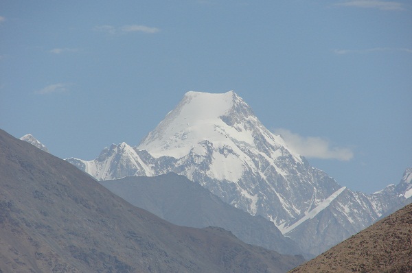
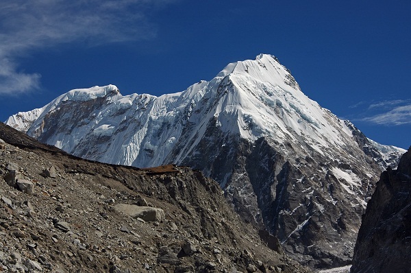
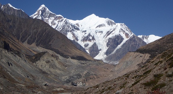
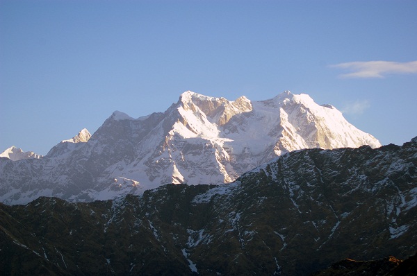
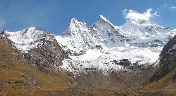
The Great Himalayan Ranges is the highest mountain ranges in the world, and the major mountain peaks are located in the Karakoram, Kanchenjunga and Garhwal Ranges, which are jointly shared by India, Pakistan, and China. The Kanchenjunga ranges, which are the third highest mountain ranges in the world located in India. They are the highest mountain ranges in India. In this article, we have classified 20 important mountains in India along with some of its important facts such as their height, parent hill, ranking, the highest peak, prominence, locations, etc. Check them out right here.
20 Major Mountain Ranges in India:
1. Kanchenjunga:
This is the 3rd highest mountain in the world and lies between Nepal and India, with 3 of the 5 peaks including the highest one lying in India. Until 1852, it was assumed that these were the highest mountain ranges in the world. However, the calculations done during the Great Trigonometrical Survey of India, in the year 1949, clarified that Mt. Everest is the highest mountain in the world and Kanchenjunga ranks 3rd.
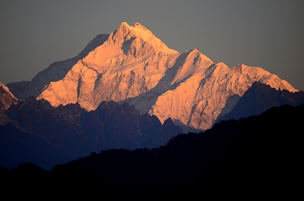
- Mountain: Kanchenjunga / Kangchenjunga
- Hill Range: Himalayas
- Height: 8586m (28169ft)
- Highest Point: There are 5 peaks of Kanchenjunga mountains
Peak, Height & Location:
-
- Kanchenjunga Main 8586m North Sikkim, India
- Kanchenjunga West 8505m Taplejung, Nepal
- Kanchenjunga Central 8482m North Sikkim, India
- Kanchenjunga South 8494m North Sikkim, India
- Kangbachen 7903m Taplejung, Nepal
- First Ascent: On May 25, 1955 by Joe Brown and George Band (First winter ascent January 11, 1986 Jerzy Kukuczka and Krzyszt of Wielicki)
- Prominence: 3922
- Location: Taplejung District, Nepal: Sikkim, India
- State: Sikkim
2. Nanda Devi:
Nanda Devi is the second highest mountain located in India, while the highest one which is entirely located in India. The world ranking of Nanda Devi Mountain is 23rd. Until 1975, this was the highest mountain in India. However, as Sikkim joined the Indian Province in 1975, Nanda Devi Mountain took the lead position making Nanda Devi Mountains, the second highest in the country. Nanda Devi means ‘Bliss giving goddess’ and is considered as the patron goddess of Uttarakhand. The Nanda Devi Mountains has one of the steepest peaks in the world.
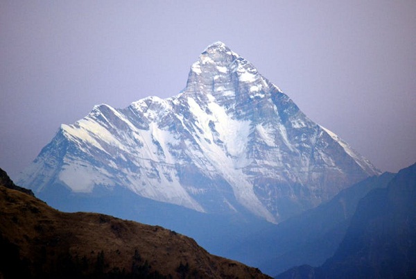
- Mountain: Nanda Devi
- Hill Range: Garhwal Himalayas
- Height: 7816m (25643ft)
- Highest Point: Nanda Devi Main
- First Ascent: August 29, 1936 by Noel Odell and Bill Tilman
- Prominence: 3139m
- Location: Chamoli
- State: Uttarakhand
3. Kamet:
Kamet is the 3rd highest mountain range in India and second highest in the Garhwal region of Uttarakhand. It looks like a giant pyramid that has a flat summit area and 2 peaks. The location of this mountain near the Tibetan plateau makes climbing extremely difficult as being near the plateau makes it extremely windy and due to the same reason, though the climbing of the range began back in 1855. Success was not received until 1931. Kamet is also the first summit over the height of 25000 feet, which was climbed and was also the highest summit reached until the Nanda Devi was conquered 5 years later.
- Mountain: Kamet
- Hill Range: Garhwal Himalayas
- Height: 7756m (25446ft)
- Highest Point: N/A
- First Ascent: June 21, 1931 by Frank Smythe, Eric Shipton, R.L. Holdsworth and Lewa Sherpa
- Prominence: 2825m
- Location: Chamoli District
- State: Uttarakhand
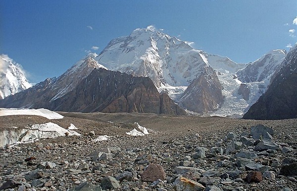
4. Saltoro Kangri / K10:
This is the highest peak of the Saltoro Mountains and a part of the Karakoram ranges. It ranks 31st in the list of the highest mountains ranges in the world, but is a very remote location situated deep in the Karakoram ranges. It draws a line between India and Pakistan with the Indian controlled territory being the Siachen region and the Pakistan controlled region of the Saltoro Range towards the West. The first attempt to climb the peak was made in 1935, by a British expedition who began the climbing from the Pakistani side but did not attempt it. The real success was received only in 1962 to the Pakistani climber R.A.Bashir. The first Indian to climb the ranges was Colonel Narendra Kumar in 1981, post which no attempt has been made till date.
- Mountain: Saltoro Kangri
- Hill Range: Saltoro Mountains, Karakoram
- Height: 7742m (25400ft)
- Highest Point: N/A
- First Ascent: 1962 by Y. Takamura, A. Saito, Capt. Bashir
- Prominence: 2160m (7090ft)
- Location: Saltoro Ridge (covering Siachen Glacier)
- State: Under India’s control. Disputed by Pakistan
5. Sasser Kangri / K22:
The Sasser Kangri is a mountain located in India. It is the highest peak of the Saser Muztagh, which is the eastern sub range of the Karakoram ranges in the west. This mountain Saser Kangri is located in the northern most state of India, the Jammu and Kashmir. It lies in the Northwest end of the Saser Muztagh and towards the head of the North Shukpa Kunchang Glacier. This is a major glacier that drains into the eastern slopes while the Sakang and Pukpoche Glaciers drain into the Nubra River.
- Mountain: Sasser Kangri
- Hill Range: Saser Muztagh, Karakoram
- Height: 7672m (25171ft)
Name of the Peak & Height:
-
- Sasser Kangri I, 7672m
- Sasser Kangri II (East), 7518m
- Sasser Kangri II (West), 7500m
- Sasser Kangri III, 7495m
- Sasser Kangri IV, 7416m
- Plateau Peak, 7287m
- First Ascent: June 5, 1973 by Dawa Norbu, Da Tenzing, Nima Tenzing, Thondup
- Prominence: 2304m
- Location: Jammu & Kashmir
- State: Jammu & Kashmir
6. Mamostong Kangri / K35:
The Mamostang Kangri is the highest peak in the Rimo Muztagh, a sub range of the Karakoram ranges situated in the Jammu and Kashmir on the eastern side towards its border with China. It is the 48th highest peak in the world in the independent category. The glaciers that head towards the slope of Mamostang Kangri include the South Chong Kumdan Glacier, Kichik Kumdan Glacier, Mamostong and South Terong Glaciers. Due to its remote location and unsettled political situation, this peak has not seen much visitation.
- Mountain: Mamostong Kangri
- Hill Range: Rimo Muztagh, Karakoram
- Height: 7516m (24659ft)
- Highest Point: N/A
- First Ascent: September 13, 1984, by an Indo-Japanese expedition lead by Col. B.S. Sandhu
- Prominence: 1803m
- Location: Jammu & Kashmir
- State: Jammu & Kashmir
7. Teram Kangri:
The Teram Kangri I is a mountain from the Teram Kangri group which is a mountain massif situated in the remote Siachen Muztagh, a sub range of the Karakoram ranges. The peak lies on the boundary between India and China on the northeast and the disputed Siachen Glacier between India and Pakistan towards the southwest. The Northeast side of the peak is currently controlled by China while the disputed Southwest part is currently controlled by India.
- Mountain: Teram Kangri
- Hill Range: Siachen Muztagh, Karakoram
- Height: 7462m (24482ft)
- Highest Point: Teram Kangri I
- First Ascent: Was in 1975 by K.Kodaka and Y. Kobayashi
- Prominence: 1702m
- Location: Jammu & Kashmir
- State: Jammu & Kashmir
8. Jongsong Peak:
The Jongsong peak is situated in the Janak section of the Himalayas. With the height of 7462m, this peak is the 57th highest peak in the world and the 3rd highest of the Kanchenjunga. The Jongsong summit is located at the tri-junction of India, China, and Nepal. From the first ascent on Jongsong on 2nd June 1930 until the first ascent to the Kamet peak on 21st June 1931, Jongsong was the highest peak climbed in the world.
- Mountain: Jongsong Peak
- Hill Range: Kanchenjunga, Himalaya
- Height: 7462m (24482ft)
- Highest Point: Jongsong Summit
- First Ascent: June 2, 1930 by Bericht Hörlin and Erwin Schneider
- Prominence: 1256m
- Location: China-India-Nepal tri point
- State: Sikkim
9. K12:
The K12 Mountains are the second highest peak in the Saltaro Mountains, a sub range of the Karakoram Range. Situated near the Line Of Control in the Siachen region in the Jammu and Kashmir, the ownership of the same is still disputed. The name K12 comes from the designation given to it during the original survey of the Karakoram Range. The western slopes of the K12 drain into the Bila fond Glacier system which flows into the Dansam River and eventually merges with the Indus River.
- Mountain: K12
- Hill Range: Saltoro Mountains, Karakoram
- Height: 7628m (24370ft)
- Highest Point: N/A
- First Ascent: 1974 by Shinichi Takagi, Tsutomu Ito (Japanese)
- Prominence: 1978m
- Location: In the Siachen area of Kashmir
- State: Jammu & Kashmir
10. Kabru:
The Kabru is a mountain located on the border of Nepal and India and is a sub range of the Kanchenjunga Mountains in the Himalayas. It is a ridge that extends towards the South of Kanchenjunga and is the South most peak in the world over 7000m
- Mountain: Kabru
- Hill Range: Kanchenjunga, Himalaya
- Height: 7412m (24318ft)
- Highest Point: N/A
- First Ascent: Disputed
- Prominence: 780m
- Location: Indo-Nepal border
- State: Sikkim
11. Ghent Kangri:
The Ghent Kangri is one of the highest peaks near the northern end of the Saltaro Mountains, a sub range of Karakoram Range. It is located in the western part of the Siachen Glacier which is under the control of Pakistan, but is very close to the Actual Ground Position Line of India. The Ghent Kangri was first climbed by an Austrian individual Wolfgang Axt. He was a member of the Austrian expedition headed by Erich Waschak via the West Ridge until the high camp post, which he climbed solo.
- Mountain: Ghent Kangri
- Hill Range: Saltoro Mountains, Karakoram
- Height: 7401m (24281ft)
- Highest Point: N/A
- First Ascent: 1961 by Wolfgang Axt (Austrian)
- Prominence: 1493m
- Location: Saltaro Ridge area of Gilgit Baltistan and disputed between India and Pakistan.
- State: Jammu & Kashmir
12. Rimo I:
At an elevation of 7385m, the Rimo I is the main summit of the Rimo Muztagh, a sub range of the Karakoram Hills. Located at the 20km northeast of the Siachen Glacier, the Rimo I is the world’s 71st highest mountain. It drains into the Shyok River. Located in the heart of the eastern Karakoram ranges. The location of the Rimo I is so remote that it was hidden from the world until the twentieth century. Besides, the unsettled political control makes the expedition even more difficult so much that the ascent until now has been tried only thrice and only once successful in the year 1988.
- Mountain: Rimo I
- Hill Range: Rimo Muztagh, Karakoram
- Height: 7385m (24229ft)
- Highest Point: Rimo I
- First Ascent: July 28, 1988, by Nima Dorje Sherpa, Tsewang Samanla (India); Yoshio Ogata, Hideki Yoshida (Japan)
- Prominence: 1438m
- Location: Siachen area of Ladakh controlled by India
- State: Jammu & Kashmir
13. Kirat Chuli:
Kirat Chuli is the mountain in the Himalayan ranges. It lies between the border of India and Nepal. The people of Sikkim and Nepal believe that the Kirat is the abode of their Omnipotent Goddess Yuma Sammang.
- Mountain: Kirat Chuli
- Hill Range: Kanchenjunga, Himalaya
- Height: 7362m (24153ft)
- Highest Point: N/A
- First Ascent: The first ascent to the summit was made by Ernst Grob, Herbert Paidar, and Ludwig Schmaderer in 1939
- Prominence: 1168m
- Location: Nepal/Sikkim
- State: Sikkim
14. Apsarasas Kangri:
Apsarasas Kangri, a mountain in the Siachen Karakoram range is the 96th highest mountain in the world and located in the border between China and Siachen Glacier controlled by India and claimed by Pakistan. The mountain was given the name Apsarasas by Grant Peterkin of the 1908 Workman Expedition which means ‘Place of Fairies.’ The mountain contains 3 main summits of the neat equal height and has been labeled I,II,III from West to East. The eastern summit is separated from the other two summits by a saddle which is just over the 6800m height. Of the 3 summits, only the western summit appears to have been climbed. The Apsarasas II and III have been labeled as the virgin peaks by the Indian Mountaineering Foundation of which the Apsarasas III or the Eastern summit is considered as the highest un climbed peak.
- Mountain: Apsarasas Kangri
- Hill Range: Siachen, Karakoram
- Height: 7245m (23770ft)
- First Ascent: Yoshio Inagaki, Katsuhisa Yabuta and Takamasa Miyamoto of the Osaka University Mountaineering Club on August 7, 1976
- Prominence: 635m
- Location: China border with the Siachen Glacier (Controlled by India and claimed by Pakistan)
- State: Jammu & Kashmir
15. Singhi Kangri:
The Singhi Kangri is a 7202m high peak situated in the Karakoram Range.
- Mountain: Singhi Kangri
- Hill Range: Teram Kangri III, Karakoram range
- Height: 7202m (23629ft)
- Highest Point: N/A
- First Ascent: 1976 by a Japanese team
- Prominence: 790m
- Location: China border with the Siachen Glacier (Controlled by India and claimed by Pakistan)
- State: Jammu & Kashmir
16. Hardeol:
Hardeol means ‘Temple of Gods.’ It is one of the major peaks of the Kumaon Himalayas. Situated in the northern end of Milam Valley in Uttarakhand, it is the highest peak in the northern side among peaks that guide the Nanda Devi Sanctuary. As Trishuli lies to its immediate North, Hardeol is also called as Trishuli South. After the first successful ascent made by the Indo-Tibetan Border Police Expedition in May 1978, only one more attempt has been recorded which was made by the Indian Border Security Force on September 24, 1991.
- Mountain: Hardeol
- Hill Range: Kumaon range, Himalayas
- Height: 7161m (23494ft)
- Highest Point: N/A
- First Ascent: May 31, 1978 by Indo-Tibetan Border Police Expedition
- Prominence: 1291m
- Location: Pithoragarh
- State: Uttarakhand
17. Chaukhamba (Badrinath Peak):
Chaukhamba is a mountainous range in the Gangotri Group of the Garhwal Himalayas. Of the group of 4 peaks, the Chaukhamba I peak is the highest with an elevation of 7138m. It lies at the face of the eastern glacier and forms the eastern leader of the group. It is located to the west of the Hindu holy town of Badrinath. After 2 unsuccessful attempts in 1938 and 1939, the Chaukhamba peak was finally climbed for the first time on June 13, 1952 by two Swiss mountaineers namely Lucien George and Victor Russen berger. The Chaukhamba I peak in an ultra-prominent peak with its prominence extending over 1500m.
- Mountain: Chaukhamba I
- Hill Range: Gangotri Group, Garhwal, Himalayas
- Height: 7138m (23418ft)
- Highest Point: Chaukhamba I
- First Ascent: June13, 1952, by Lucien George and Victor Russen berger
- Prominence: 1594m
- Location: Towards the west of the holy town of Badrinath
- State: Uttarakhand
18. Nun-Kun:
The Nun-Kun Mountain massifs is a pair of Himalayan peaks Nun 7135m and its adjacent Kun Peak at 7077m. The Nun is the highest peak lying on the Indian side of the Himalayan ranges. It should be noted that there are higher peaks in India, but they belong to the Karakoram ranges and not the Himalayas. The Kun peak is located towards the north of Nun and is separated by a 4km long snowy plateau. The pinnacle peak is the third highest summit of this group with a height of 6930 m.
- Mountain: Nun-Kun
- Hill Range: Zanskar, Himalayas
- Height: 7135m (23408ft)
- Highest Point: Nun
- First Ascent: 1953 by Pierre Vittoz, Claude Kogan
- Prominence: 2404m
- Location: Suru Valley, 250 km east of Srinagar
- State: Jammu and Kashmir
19. Pauhunri:
This is a mountain in the Eastern Himalayas. It is located on the border between India and China in Sikkim that also marks the origin of the Teesta River. It is situated 75km northeast of Kanchenjunga. Alec Kellas first climbed the Pauhunri in 1911, and not known then. It was revealed 80 years later that it was the highest climbed the mountain on Earth for 19 years, i.e. from 1911 till 1930 until when Jongsong Peak was climbed in 1930.
- Mountain: Pauhunri
- Hill Range: Eastern Himalayas
- Height: 7128m (23386ft)
- Highest Point: N/A
- First Ascent: 1911 by Alec Kellas
- Prominence: 2035m
- Location: Sikkim – Tibet border
- State: Sikkim
20. Trisul:
These mountain ranges have been named as Trisul as it is a group of 3 Himalayan mountain peaks located in the Western Kumaun, which resemble the Trisul, the weapon of Lord Shiva. The Trisul forms the southwest corner of the ring that encloses the Nanda Devi Sanctuary. The main peak of Trisul, Trisul 1 was the first peak over 7000m height to have been successfully climbed in 1907. The other two Trisul II and Trisul III at the height of 6690m and 6007m respectively were climbed only in 1960.
- Mountain: Trisul
- Hill Range: Kumaun Himalayas
- Height: 7120m (23360ft)
- Highest Point: Trisul I
- First Ascent: Was on12 June 1907 by Tom Long staff, A. Brocherel, H. Brocherel, Karbir
- Prominence: 1616m
- Location: Bageswar
- State: Uttarakhand
India is thus a land with some of the highest mountain ranges and roads that act as a natural shield from the neighbouring countries. These mountains are very high and the terrain is such that it cannot be easily invaded. The aforesaid is the list of 20 highest mountain peaks in India, the highest of them being the Kanchenjunga Mountains in Sikkim. The list is inclusive and not exhaustive. There are more such mountain ranges that protect India from the eastern and western side as well.
Frequently Asked Questions & Answers:
1. Name The Highest Mountain Peak in India?
Ans: The Kanchenjunga mountain peak with a height of 8586m (28169ft) is the highest mountain peak in India. It is also the third highest summit in the world. The Kanchenjunga mountain ranges are located in the Great Himalayan ranges in Sikkim and are the top mountain in India.
2. How Many Mountains are There in India?
Ans: India is home to 7 major mountain ranges in India that have their peaks over 1000m. The most famous mountain range of the world is the Himalayan mountain ranges also fall in India. The remaining 6 are the Karakoram and PirPanjal Range, Eastern Mountain Range, The Saputara and the Vindhya Range, the Aravalli Range, the Western Ghats, and the Eastern Ghats.
3. List The Famous Mountains in India.
Ans: The following is the list of 10 most famous mountains in India:
- Kanchenjunga
- Nanda Devi
- Anamudi
- Kamet
- Dodabetta
- Guru Shikhar
- Trisul
- Chaukhamba
- Kalsubai
- Mullayanagiri
4. Which is the largest mountain in India?
Ans: Kanchenjunga is the largest mountain in India and third largest in the world after the Mount Everest and Godwin Austen also known as K2.
5. Which is the tallest mountain in India?
Ans: With a height of 8586m, the Kanchenjunga Mountains are the tallest mountains in India.


