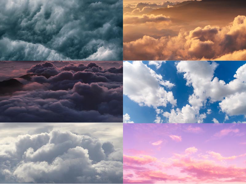
Have you ever had a look at the sky and wondered how clouds look different at different times? Clouds come in all shapes and sizes because all are not created equal. Some are erratic and inconsistent, while some clouds are puffy and sweet. Although all clouds are made of ice crystals and water droplets, different types of clouds are classified depending on the form and how high up they hover in the troposphere.
In this article, we have provided you with the major types of clouds and their differentiating characteristics. Read on!
Main Groups Of Clouds:
There are three primary levels for dividing the types of clouds with different groups of clouds that make up for Ten fundamental kinds of clouds.
- High-Level Clouds:
Clouds that form above 20,000 feet are called High-level clouds. Cirrus, Cirrostratus, Cirrocumulus are examples of high-level clouds.
- Middle-Level Clouds:
Clouds that form between 6,500 and 20,000 feet are called middle-level clouds. Altocumulus, Nimbostratus, Altostratus are examples of middle-level clouds.
- Low-Level Clouds:
Clouds that form below 6,500 feet are called low-level clouds. Cumulus, Stratus, Stratocumulus are examples of low-level clouds.
Different Types Of Clouds:
Below, we have given you detailed information about the types of clouds and their characteristics, differentiating features, and weather effects. Scroll down.
High-Level Cloud Types:
1. Cirrus Clouds:
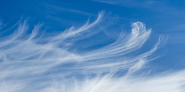
Cirrus clouds are thin, wispy, have a silky sheen appearance that can be seen any time of the year, and are one of the most common types of clouds. The cirrus cloud’s transparency is determined by the degree of separation of ice crystals. Besides their filament appearance, these clouds are often coloured in bright yellow or red before sunrise and after sunset, respectively making them stand out among other cloud types. Although Cirrus clouds occur in fair weather, it might also indicate a storm coming.
- Colour: Bright yellow before sunrise, red after sunset.
- How They Look: White wispy strands of clouds that streak across the sky.
- Formation: Fairweather.
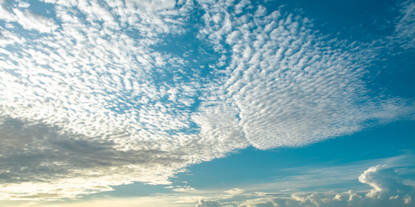
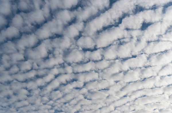
2. Cirrocumulus Clouds:
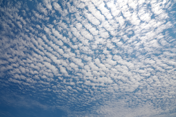
The types of clouds made of ice crystals often arranged in rows that live at high altitudes are called Cirrocumulus clouds which are small. Compared to altocumulus and stratocumulus, Cirrocimulus are much smaller, and the individual cloud mounds are called “cloudlets.” These clouds are relatively short-lived; they do not produce rain and are rare.
Cirrocumulus clouds are often referred to as mackerel skies because they look a bit like fish scales, which are spread miles over the sky with small white puffy patterns. These clouds look gorgeous and exhibit features of both cirrus and cumulus clouds.
- Colour: Grayish.
- How They Look: White puff patterns.
- Formation: During winter.
3. Cirrostratus Clouds:
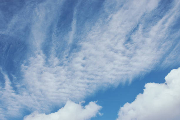
Cirrostratus clouds are whitish, transparent clouds covering nearly the entire sky or forming a veil. The “halo” or circle of light is the dead giveaway distinguishing these clouds formed by the ice crystals refracting the light from the sun or moon. A large amount of moisture in the upper atmosphere results in Cirrostratus clouds. The approaching warm fronts are also associated with these clouds. If Cirrostratus clouds descend into lower altitudes, they can become altostratus clouds.
When there is a formation of Cirrostratus clouds in the sky, it means there is an imminent rainfall in the next 24 hours.
- Colour: Light grey to white.
- How They Look: Sheet like appearance.
- Formation: Warm frontal system.
Mid-Level Cloud Types:
4. Altocumulus Clouds:
Altocumulus clouds are usually found in the middle atmosphere and are the most common clouds. These clouds are nicknamed “sheep backs” and “mackerel skies” because they look like sheep’s wool or scales of mackerel fish. Altocumulus clouds indicate thunderstorms that might come later in the day. These clouds are made mainly of water droplets because they form lower altitudes. However, they might retain ice crystals when they are starting higher up. There is also a chance of the Altocumulus cloud formation combined with other clouds like cumulonimbus.
Altocumulus clouds typically precede altostratus when a warm frontal system is advancing. Usually, they appear between lower stratus clouds and higher than cirrus clouds. A storm usually follows when altocumulus appears with another cloud type. There is a projection of light to moderate rainfall with altocumulus.
- Colour: White or grey patches.
- How They Look: Large rounded masses or aligned in parallel bands.
- Formation: Warm and humid mornings, during summers or ahead of cold fronts.
5. Altostratus Clouds:
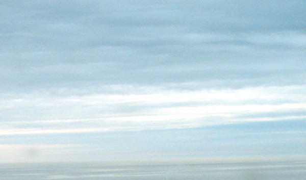
Altostratus clouds partially or cover the sky at mid-levels that appear bluish-grey or grey. You can typically see the sun as a dimly lit disc behind these clouds, even though they cover the sky. These clouds are strongly linked to light rain or snow and are often spread over thousands of square miles. It is common for altostratus clouds to morph into nimbostratus clouds that deliver a pounding. However, they are not capable of yielding heavy rain.
Altostratus clouds are often referred to as “boring clouds” because they are uniformly grey, smooth and mostly featureless. These clouds often precede nimbostratus clouds and are usually found during an advancing warm frontal system.
- Colour: Gray or Bluish-gray.
- How They Look Like: Sheets.
- Formation: Ahead of a warm or occluded front, together with cumulus at a cold front.
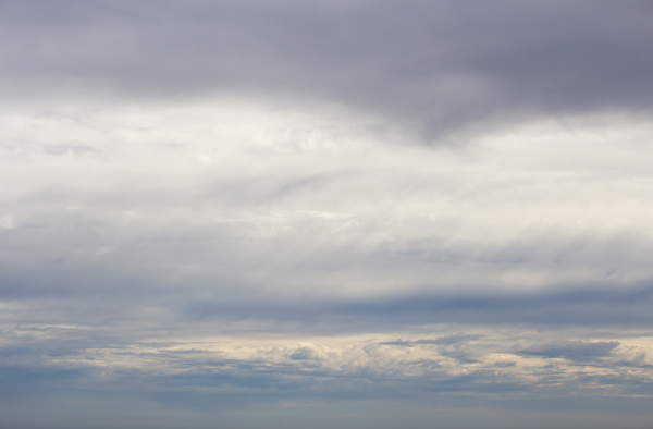
6. Nimbostratus Clouds:
Nimbostratus clouds are thick enough to block the sun and cover the sky, forming a dark grey layer extending from the low and middle layers of the atmosphere. You can see Nimbostratus clouds whenever there is a steady snowfall or rainfall. Therefore they are called the quintessential rain cloud. These gloomy clouds completely block the sun by forming thick and dark layers of clouds and heavy rain bearers. Nimbostratus clouds sometimes descend to lower altitudes, though they belong to the middle-level category.
Nimbostratus clouds form when the warm frontal system lifts the warm and moist area higher up in the atmosphere, condensing, resulting in the gradual accumulation of damp area. The formation of nimbostratus might be the result of spreading cumulonimbus clouds.
- Colour: Dark grey.
- How They Look: Thick and dark layers.
- Formation: When there is steady rain or snow.
Low-Level Cloud Types:
7. Stratus Clouds:
Stratus clouds resemble fog that hugs the horizon, which hangs low in the sky, like a featureless cloud that is greyish. These clouds are associated with light mist or drizzle and are seen on dreary, overcast days. Stratus clouds cover a large area of the sky and are composed of thin clouds. These clouds condense after rising to the atmosphere by forming large air masses. These clouds are pretty benign in producing light showers or even light snow. However, these clouds can transform into nimbostratus if enough moisture is retained at the ground level. Stratus clouds are commonly found in coastal and mountainous regions, though they are common worldwide.
- Colour: Greyish.
- How They Look: Flat, featureless.
- Formation: Dreary, overcast days.
8. Cumulus Clouds:
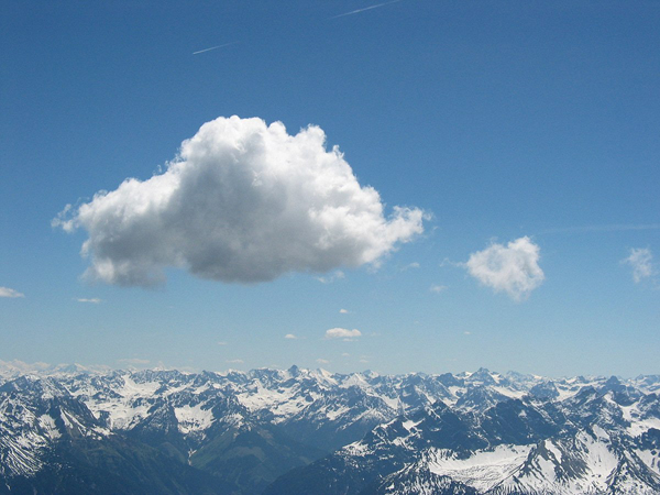
Cumulus clouds are the most recognizable clouds and signify fair weather. Leaving out polar regions, you can find these clouds virtually anywhere. Cumulus clouds are the common representation used to symbolize clouds in general. These clouds’ bottoms are relatively dark and flat, while their tops are rounded, puffy and brilliant white when sunlit. These clouds get their nickname “fair weather” clouds because they develop on clear, sunny days when the sun heats the ground.
- Colour: White while sunlit, bottoms are relatively dark.
- How They Look: Piles of cotton.
- Formation: They appear in the late morning and disappear in the evening.
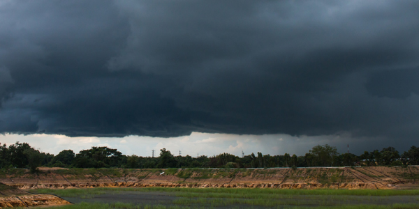
9. Cumulonimbus Clouds:
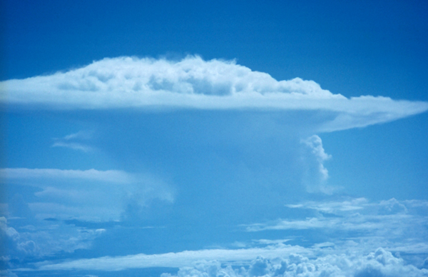
Cumulonimbus clouds rise into towers with bulging upper portions which look similar to cauliflower. At the same time, their tops are always flattened, and bottoms are often dark and hazy. Cumulonimbus clouds are also called Tower clouds because they grow up to eight kilometres. These vertical clouds are visible when there is a threat of severe weather because they are thunderstorm clouds that cause possibly tornadoes, hail, heavy periods of rainfall.
Ice crystals dominate the cloud in high altitudes, and the cloud is mainly made of water droplets at low altitudes. So these clouds can cause pouring though it might come and go.
- Colour: Dark and hazy.
- How They Look: Tower shape.
- Formation: Afternoons of summer and Spring months.
10. Stratocumulus Clouds:
Stratocumulus clouds are low, puffy, greyish or whitish clouds that occur in patches with visibility of blue sky in between them. These clouds have a dark and honeycomb appearance when viewed from underneath. The formation of these clouds occurs when the atmosphere has weak convention and most likely on cloudy days. These clouds are far more giant, though they resemble cumulus clouds. The pattern of the cloud with itself makes the upper part of the cloud look ragged while the base is well-defined and flat. The stratocumulus has light to dark grey hues depending on the thickness of the cloud, and they only give a drizzle.
- Colour: Light to dark grey hues.
- How They Look Like: Thick white blanket of stretched out cotton.
- Formation: Cloudy days.
Interesting Facts About Clouds:
Here are some facts about clouds you might find interesting:
- A tiny group of water droplets that can be seen in the air is called a cloud.
- Though no one knows the reason, thunderstorm clouds can be green.
- There is a society that appreciates clouds with 40,000 members, and it is called a cloud appreciation society.
- Pareidolia is the psychological phenomenon of seeing objects in clouds.
- The water on Earth evaporates into the sky condenses high up in the cooler air forming clouds.
- You can find millions of tons of water in the clouds.
- Stratus, cumulus, and cirrus are the different main types of clouds.
- Stratus clouds appear as layered sheets that are flat and featureless. Cumulus is like cotton floating in the sky because they are puffy. Cirrus seems high in the sky and is thin and whispy.
- A cloud that appears very close to the ground is fog, a stratus type of cloud.
FAQ’s:
1. Are there clouds on other planets?
Other planets also have clouds made of other chemicals. For example, there are clouds made with sulfur dioxide in Venus and ammonia clouds in Jupiter and Saturn.
2. What is a cloud’s average weight?
A cumulus cloud is a fluffy white that weighs about 500 tonnes, like a jumbo jet.
3. How do the clouds float?
The tiny droplets present in the clouds have the viscosity of the air. This means they fall very slowly, and even a tiny updraft keeps the cloud up.
4. What are the rare types of clouds?
Here are the seven types of rare and unique clouds:
- Mammatus clouds.
- Arcus clouds.
- Altocumulus castelanus.
- Mushroom clouds.
- Noctilucent clouds.
- Nacreous clouds.
5. What is the composition of extraterrestrial clouds?
Venus has clouds of sulphur dioxide, the smell of just-lit matches or set-off fireworks. In addition, hydrogen, helium gas, plasma and cosmic dust are present in nebulae, otherwise known as Interstellar clouds.
Disclaimer: The information provided in this article is based on research. The website is not responsible for the authenticity and accuracy of the information.


